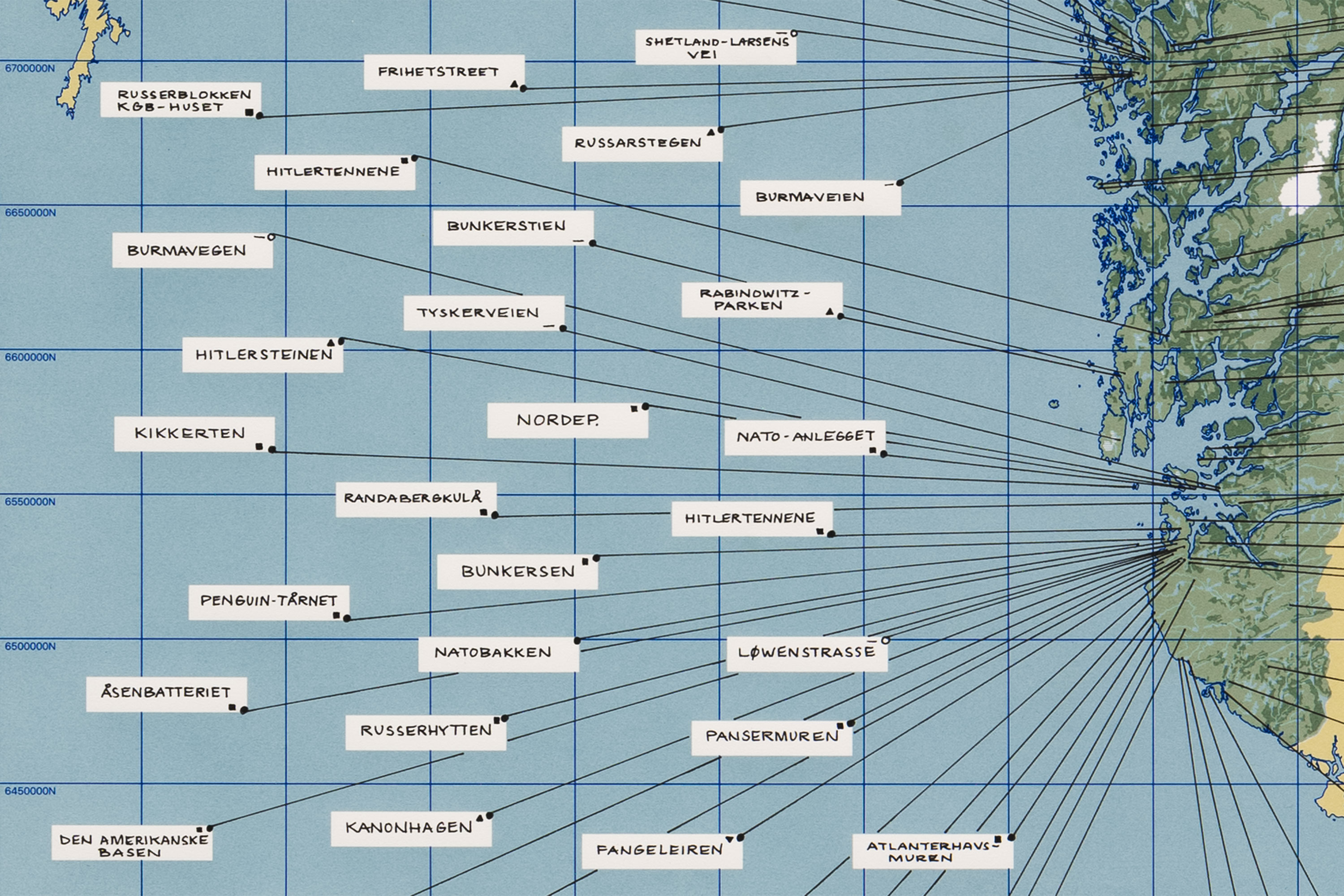
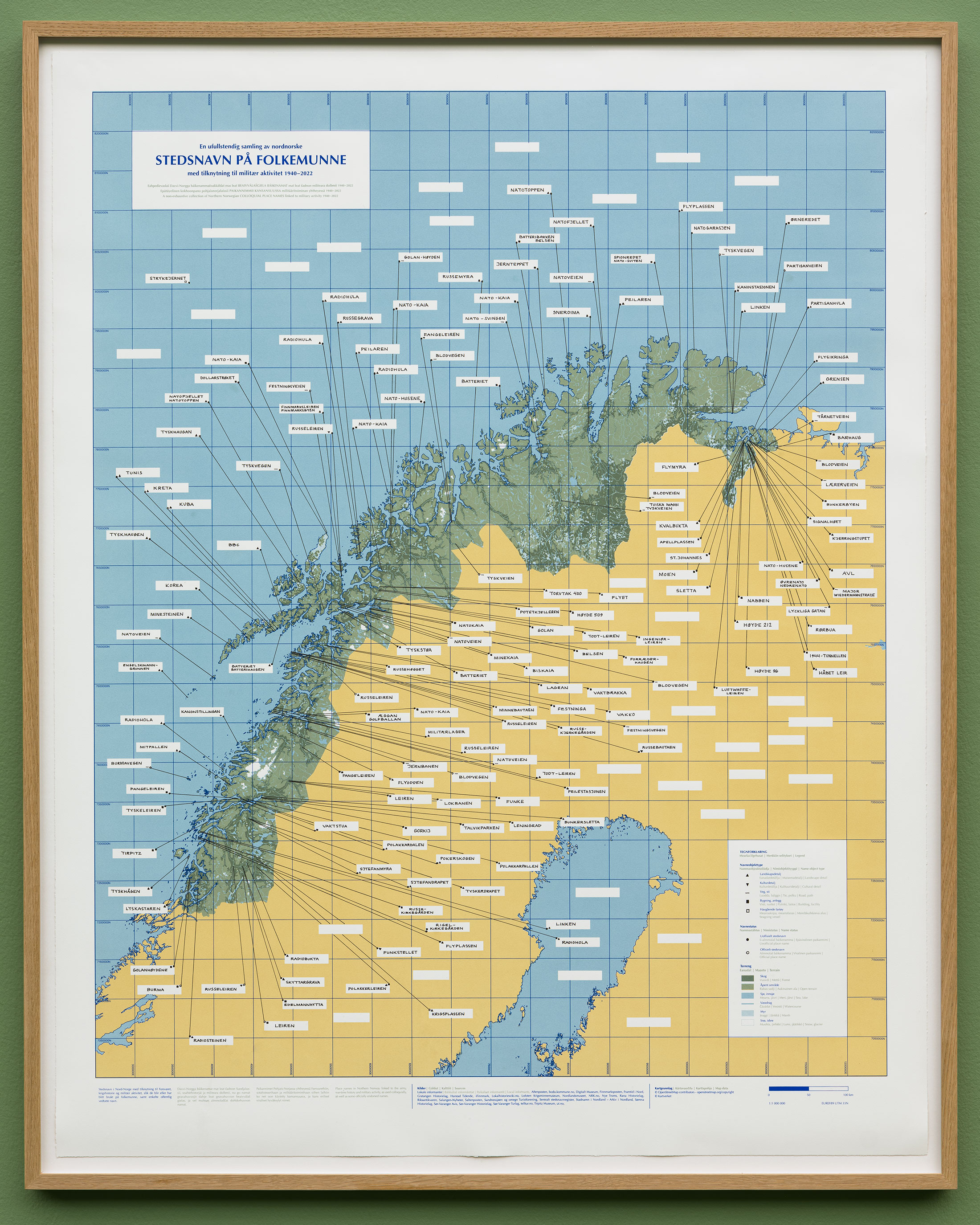
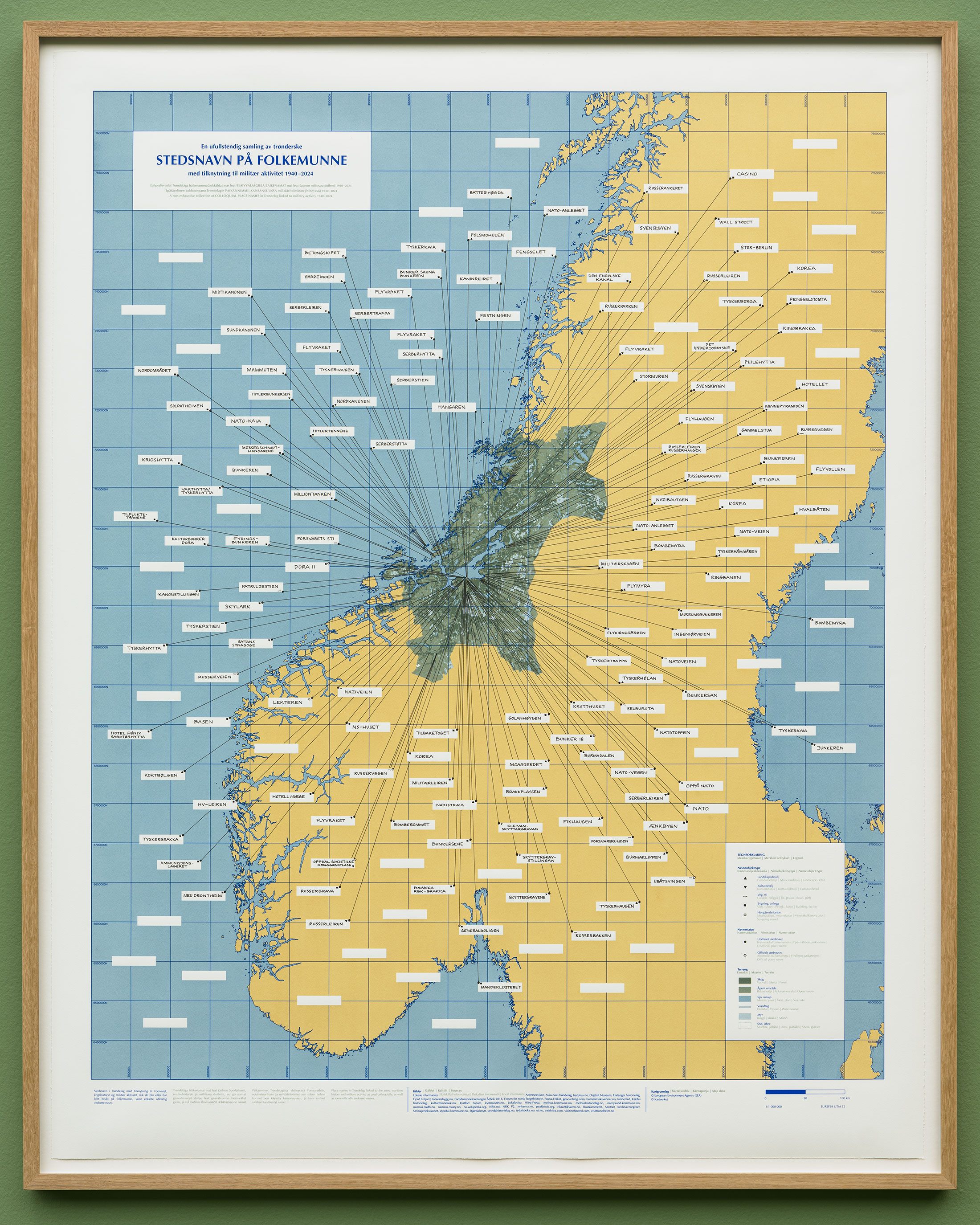
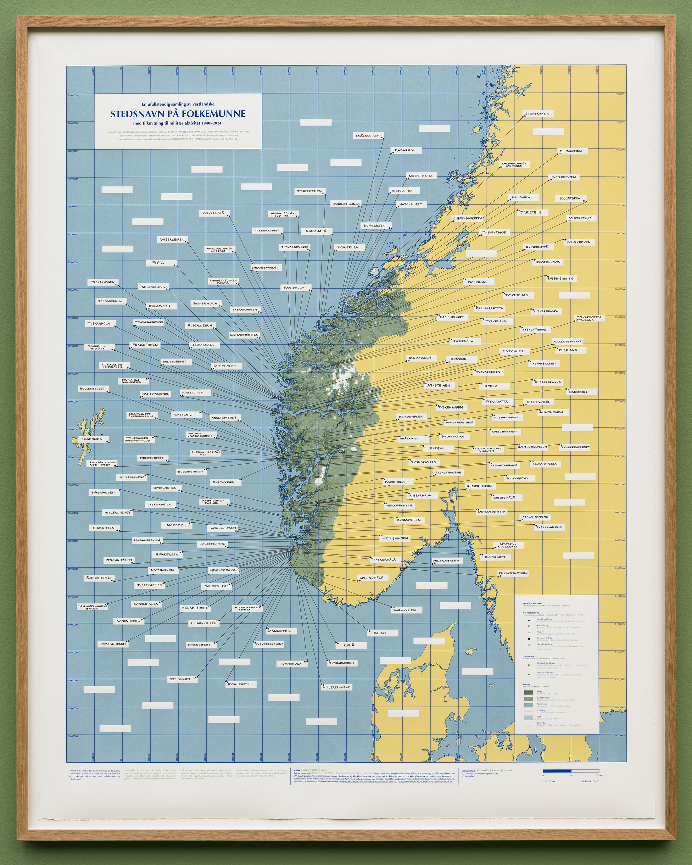
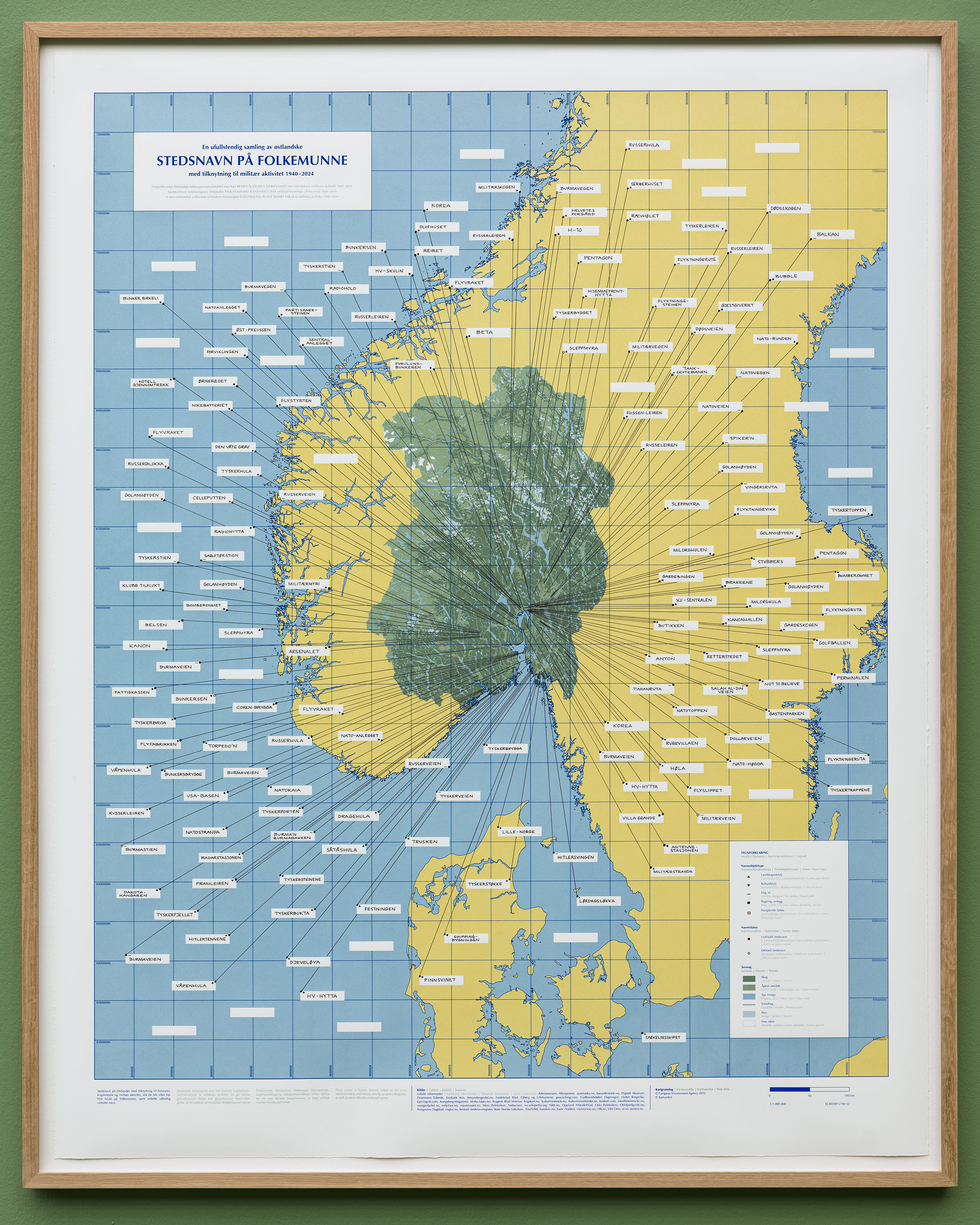
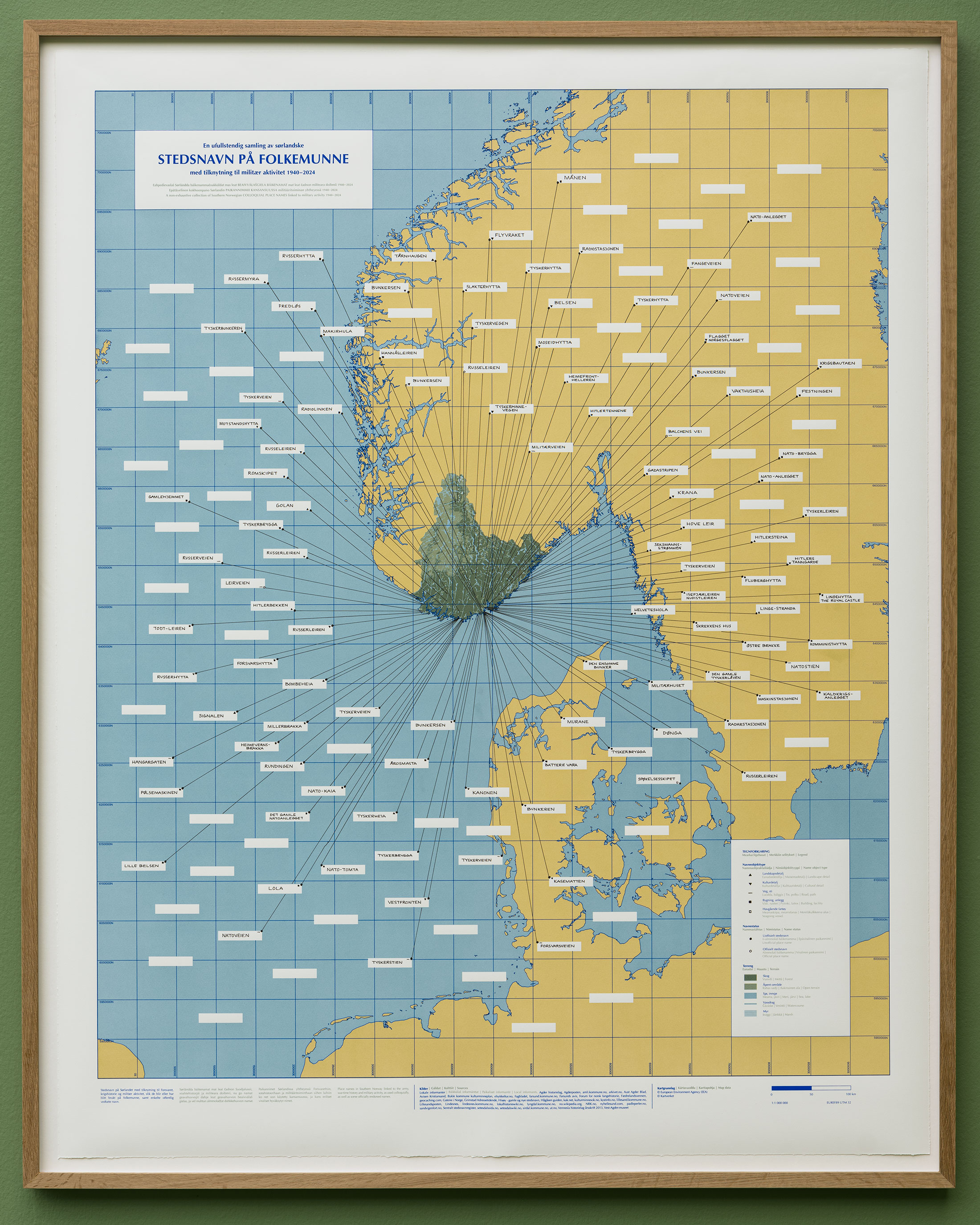
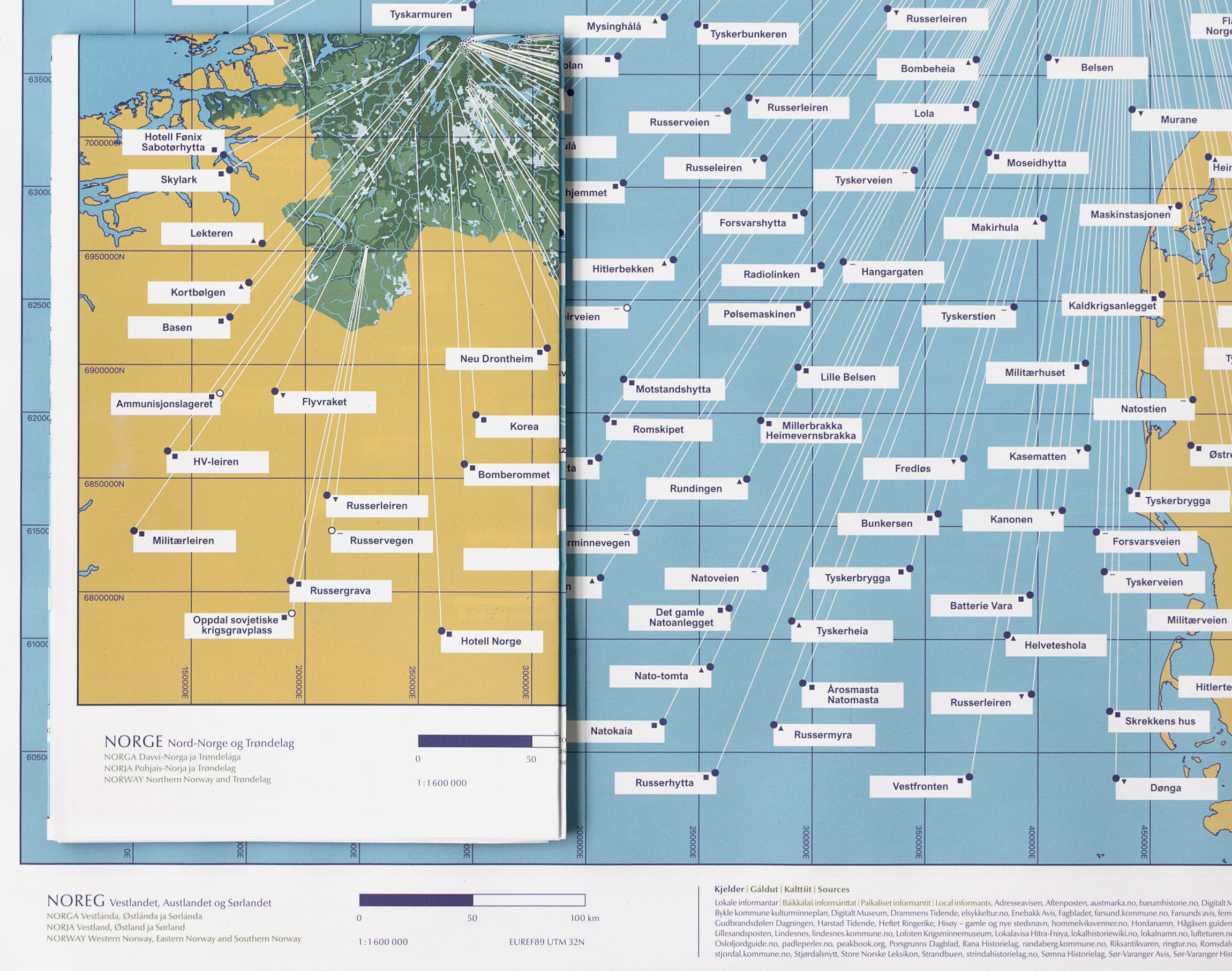
The five silkscreen prints in the series Colloquial place names linked to military activity show maps of Norway with nicknames of places, landmarks, mountains, lakes, buildings or roads associated with the Norwegian Armed Forces, war history and military activity. The origins of the names range from the 1940’s to the present day, and are collected from local informants and written sources. The vernacular and informal language is indicative of the traces that the presence of the military has left and how it is remembered and materialised in civil society.
The stories behind the place names are often that they have arisen spontaneously as descriptions of infrastructure and events related to the Second World War, the Cold War, the Norwegian Armed Forces and NATO, as well as some names that are associated with other places in war or conflict.
A place name that marked a starting point for the project is «NATO-fjellet» (NATO mountain), also known as «NATO-toppen», a small mountain peak in Stø in Øksnes not far from where I grew up. The name refer to the coastal radar on top of the peak. The same name is also found elsewhere, for example in Honningsvåg, in this case referring to an Air Force station connected to NATO’s NADGE system. Another example is «Kaninstasjonen» (Rabbit station), the Norwegian Armed Forces’ Experimental Station in Vadsø, where one of the explanations for the name is linked to the term «forsøkskanin» (research rabbit / Guinea pig), a nod to the testing activities at the facility. Many of the place names, such as «Fangeleiren», «Radiohula», «Peilaren» and «Blodvegen», refer to activities that took place during the Second World War, and several of them point to dark chapters in war history, such as «Russergrava», Oppdal Soviet war cemetery, where Soviet prisoners of war from the Furuly prison camp are buried. Another category of place names in the maps refer to wars and conflicts in other parts of the world. Names such as «Golanhøyden» and «Korea», for instance, can be found in many parts of the country, as well as «Burmaveien», which is also an official name for roads in several places.
The map of Northern Norway is from the project Presence, commissioned by KORO and Evenes Air Station/Forsvarsbygg, 2022. The subsequent works in the series were created in 2024 and first shown in the exhibition Deterrence and Reassurance, The Festival Exhibition 2024, at Bergen Kunsthall.
The series is also published as a two-sided poster/foldable map in a smaller size, printed as offset in an edition of 500 copies. Published by Tromsø Kunstforening and Mondo Books (2025). Typography and preparation for printing: Øystein Arbo Studio.
Production:
Researchassistants, place names: Linn Heidi Stokkedal, Anna Näumann, Tiina Portti, Maud Pold
Text consultant: Audun Lindholm
Print: Printed in collaboration with Daniel Persson, Trykkeriet i Bergen
Translations: Marit Breie Henriksen (Northern Sámi), Mari Keränen, Kainun institutti – Kvensk institutt (Vven), Lucy Moffatt (English)
Supported by: Bergen Kunsthall, Billedkunstnernes Vederlagsfond, Kulturrådet and Regionale prosjektmidler fra Kunstsentrene i Norge (2024), and KORO (2022).
Many thanks to all collaborators and to everyone who has contributed knowledge about place names and local history.
-

«Colloquial place names linked to military activity (Northern Norway)», (2022), 140 x 110 cm
-

«Colloquial place names linked to military activity (Trøndelag)», (2024), 140 x 110 cm
-

«Colloquial place names linked to military activity (Western Norway)», (2024), 140 x 110 cm
-

«Colloquial place names linked to military activity (Eastern Norway)», (2024), 140 x 110 cm
-

«Colloquial place names linked to military activity (Southern Norway)», (2024), 140 x 110 cm
-

«Colloquial place names linked to military activity (Norway)», (2025), 89 x 70 cm, offset print.
